
Drone Data You Can Use
We provide practical aerial imagery that you can count on for all kinds of surveying and construction projects.
Drone Services
FAA PART 107 LICENSED
We offer a variety of aerial mapping and photography services in the Midsouth, including LiDAR and Point Cloud data collection. If you have a special need and you think aerial imagery may save you money or improve your work flow, then please call us today so we can help!
-
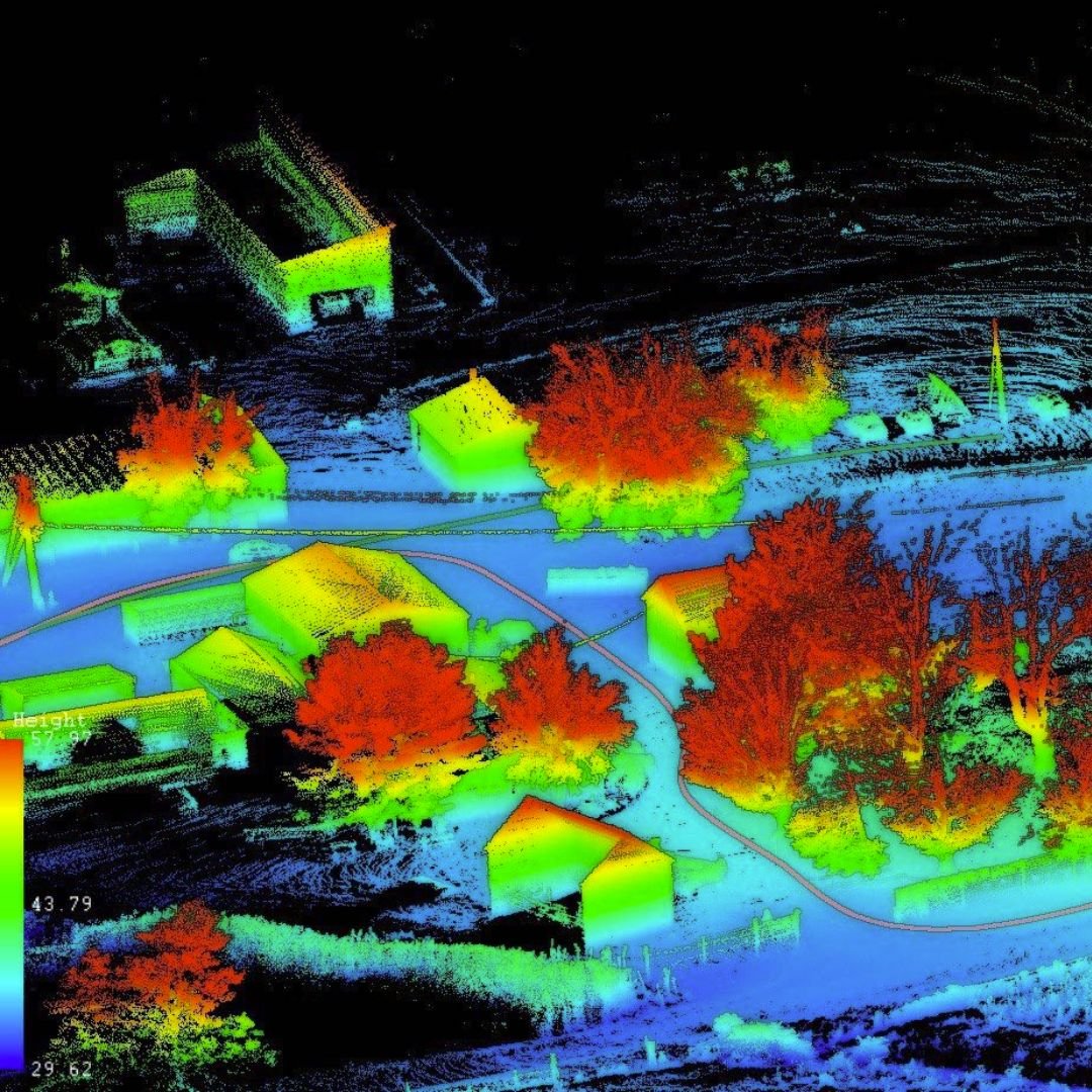
At the very core of our service is lidar mapping. We provide highly accurate point cloud deliverables to surveyors and engineers. Our Lidar data is tied directly to your control for seamless merging of the deliverables. Along with Lidar, we provide photogrammetry services for highly accurate 3D models and orthomosaic maps. Deliverables are provided in the requested format ready to use in your CAD software. We can provide Orthomosaic maps of the entire property, Digital Surface Models, Contours, and 3D Models. Accuracy is essential and MDS will provide the level you need and expect.
-
Drones have become the number one tool for providing inventory of aggregate removed from or delivered to development site. We can provide accurate volume measurements of aggregate inventory removed or delivered to your development site.
-
Drone imagery for constructions sites is used for many purposes. A few include Drone Mapping, Asset Inventory Management, and Progression Images. All of these can help save time and money by identifying problems early on. Job site imagery can be shared with investors, architects, and anyone else involved with the project but located many miles away.

Need drone equipment? Look no further than Drone Mapping Tools, your one-stop shop for drones, Lidar, software, & more.
The Sky’s the Limit
Midsouth Drone Services is a leader in providing the drone data you need. Whether it is professional imagery or highly accurate maps, we can provide the specific product that you need. We have extensive experience flying drones and doing professional photography. Accurate, relevant data can save you money, make you money, and make you more efficient. This meaningful data could include highly accurate digital surface maps, 3D models of a completed project, or thermal imagery to show water damage on roof tops.
Hear From Customers
FAQs
-
We focus on capturing aerial data for our customers, who are often in the construction and surveying industry, so we don’t do any event-related jobs.
-
We do not have a certified surveyor on staff, but we do have partnerships with land surveyors that enable us to present you with signed and stamped data.
-
Yes! Head over to DroneMappingTools.com for all your equipment needs!
-
No, we don’t do any repair work.
